Isochrone Mapping (Feature concept)
Problem
Security managers and emergency responders often need to estimate where someone might be based on their last known location. The challenge: visualize likely travel zones in real time on our existing Mapbox platform.
Solution
Using Mapbox's Isochrone API, I built a JavaScript prototype that rendered live travel-time polygons for walking, cycling, and driving, accounting for road networks and traffic. Domain experts evaluated the prototype to define the right use cases, leading to final Figma mockups and a full feature spec ready for the Agile team.
Tools
Javascript, Mapbox platform, Figma for final designs, Maze.co for remote testing and feedback
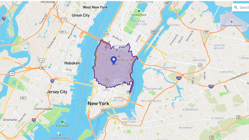
Isochrone prediction of walking distance from a point
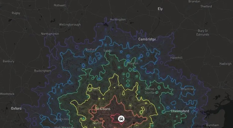
Driving prediction from London with multiple timeframes
TOP